Geologic maps of select Mesozoic rift basins in eastern North America
Geologic maps of select Mesozoic rift basins in eastern North America (see location map below). The Jeanne d’Arc basin is in the northern segment of the rift system. The Taylorsville, Richmond, Danville/Dan River, and Deep River basins are in the southern segment. The other basins are in the central segment. The Newark, Gettysburg, and Culpeper basins are part of larger rift zone called the Birdsboro basin by Faill (2003). The map of the entire Fundy basin in B1 is displayed at half the scale of all other maps. Click on the image to see a larger version. Modified from Schlische (2003) and Withjack et al. (2012, 2022).

Select cross sections of Mesozoic rift basins in eastern North America

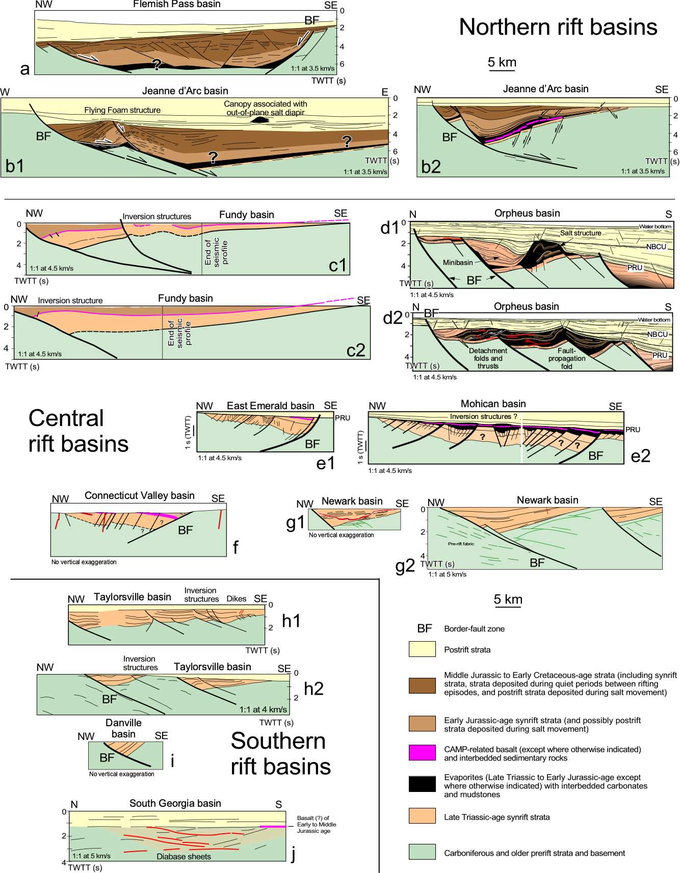
Select cross sections of Mesozoic rift basins in eastern North America grouped by rift-system segment: northern, central, and southern. All sections are at the same scale. All but the Connecticut Valley and Danville basin sections are based on interpretation of seismic-reflection profiles. Click on the image to see a larger version. Modified from Withjack et al. (2012, 2022).


Map showing the location of the Newark basin and other Triassic-Jurassic rift basins in eastern North America. Labeled basins are shown in maps and cross sections above. Red lines show locations of cross sections for offshore basins. Modified from Withjack et al. (2020).

Map showing the location of the Newark basin and other Triassic-Jurassic rift basins in eastern North America